Aerospace CNC machining is the backbone of modern aircraft production. This guide explains the theory and practice behind it.
Be the first to know.
Get our Aerospace weekly email digest.
Category
Aerospace
Engineers Wiki. Most Asked Questions.
Applications of 3D Printing: From Industry to Electronics and Beyond
By Benedict O'Neill.
12 minutes read.
Verilog vs VHDL: A Comprehensive Comparison
By Muhammad Sufyan.
16 minutes read.
Lidar SLAM: The Ultimate Guide to Simultaneous Localization and Mapping
By Saliha Malik.
16 minutes read.
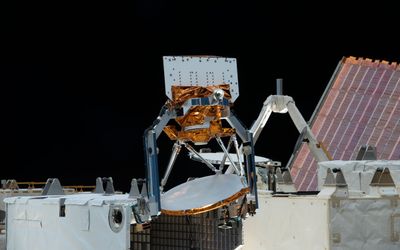
James Webb Space Telescope Science Instruments Explained
By Ravi Rao.
9 minutes read.
ORGANIZATIONS. SHAPING THE INDUSTRY.


InDro Robotics
Robotics and Drones
We empower R&D by providing the computational power, ROS packages, payloads...
14 Posts

View more
TAGGED WITH micro air vehicles (mavs)
How standardized electronic identification will enable high-volume, complex drone operations.
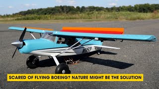
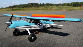
In this episode, we explore how the mechanics of bird wings are inspiring new approaches to prevent airplanes from stalling and learn how bio-mimetic designs from nature are paving the way for innovations in aviation, enhancing stability and safety for future flights.
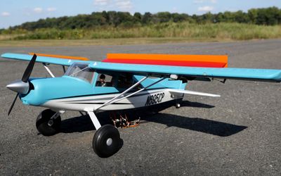
Taking inspiration from bird feathers, Princeton engineers have found that adding rows of flaps to a remote-controlled aircraft’s wings improves flight performance and helps prevent stalling, a condition that can jeopardize a plane’s ability to stay aloft.
In today’s world, continuous connectivity sounds like an everyday given. But delivering it is far from simple.
TAGGED WITH space
Humanity's drive to explore has taken us across the solar system, with astronaut boots, various landers and rovers' wheels exploring the surfaces of several different planetary bodies.
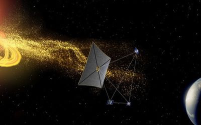
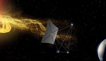
A spacecraft that sails on light could provide new vantage point on solar eruptions that can disrupt modern electrical and navigation systems.
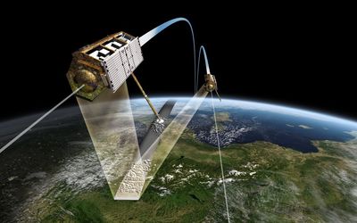
In space, maintenance isn't possible, so satellites must operate reliably for their entire mission. This makes fault detection, isolation, and recovery (FDIR) a critical requirement in satellite design.

Small devices can loft into mesosphere for climate sensing

Latest Posts
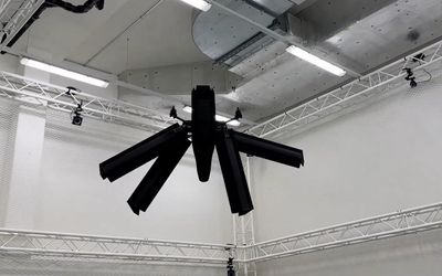
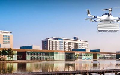
Elythor, an EPFL spin-off, has developed a new drone whose wing shape can adapt to wind conditions and flight position in real time, reducing the drone’s energy consumption. What’s more, the position of the wings can change, allowing the drone to fly vertically or horizontally. These features make it a perfect candidate for inspecting power plants.

4 minutes read


In this article, we will dive deep into the world of simultaneous localization and mapping using Lidar technology. Lidar SLAM has been gaining popularity in recent years, thanks to its versatility and applications across various domains, including autonomous vehicles, mobile robotics, and indoor mapping.


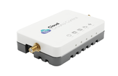
CGConnect, its cellular micro-modem that uses 4G/5G networks to link any drone or robotic vehicle to Cloud Ground Control’s cloud-based drone fleet management platform, enabling live-streaming, command and control from a web browser.

2 minutes read
As evidence mounts that gas drilling and sewer systems leak far more greenhouse gases than previously believed, a team of Princeton researchers has developed a method to pinpoint leaks both big and small for speedy repair.


MIT researchers exhibit a new advancement in autonomous drone navigation, using brain-inspired liquid neural networks that excel in out-of-distribution scenarios.

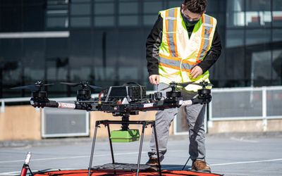
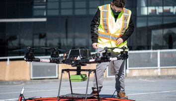
Intelligent flying robots can perform Non-Destructive Testing inspections on various assets across various industries, including tanks, towers, pipes, flare stacks, ships, and more.

In this episode, we talk about a new satellite system from NASA that leverages technologies used in other missions to accomplish the same performance that has been delivered by heritage satellites but smaller and less complex while also being a fraction of the cost.
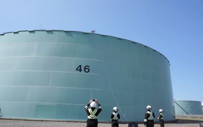
Refineries are known for operating under harsh conditions of high pressure and temperature, which can cause damage to equipment over time, leading to defects such as internal corrosion, cracking, and erosion.
3 minutes read
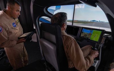
Air taxis and flying cars may seem like science fiction, but for Onland, founder of Serendipity, these are real-world technologies he’s helping cities and countries prepare for now.

4 minutes read

In places across the U.S., tree cover is shrinking – forests are burned by wildfires on the West Coast and drowned by rising sea levels along the East. From the ground, it’s hard to assess the scale of the losses and the effects disappearing trees have on atmospheric carbon dioxide levels and climate change.

In a world that runs on data, computer simulations are among our most powerful tools for investigating any scenario. The same is true for NASA Advanced Air Mobility (AAM) researchers as they plan the future of the national airspace. Together with industry partners, these researchers are delivering the data needed to allow self-flying electric air taxis and drones to execute flight paths as easily as your phone maps your car’s route.

3 minutes read


Sustainable aviation fuels (SAFs) significantly reduce the climate impact of aviation in terms of both its carbon footprint and other climate impact not related to carbon dioxide. In the future, the targeted use of SAFs in contrail regions can help to rapidly reduce the climate impact of air transport. Flight tests using aircraft powered by 100 percent SAF are to take place again in order to prepare for this transition.

3 minutes read


Intelligent Flying Robots have revolutionized NDT inspections by conducting accurate ultrasonic thickness (UT) and visual inspections in challenging conditions.

Engineering and service provider for the space technology sector turns to Online Manufacturing for procuring prototype components

3 minutes read
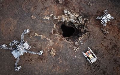
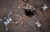
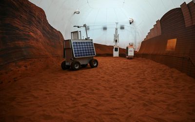
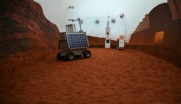
As potential locations for future base camps, the lava caves on the moon are of great interest. But how can they be reached and explored? This has been investigated by a European consortium coordinated by the German Research Center for Artificial Intelligence (DFKI) in the project CoRob-X