Marine Science: Driving Research and Solutions for Environmental Sustainability
Explore how Marine Science benefits from ROV technology to improve environmental monitoring and enhance research efforts for more efficient and precise results.
06 Sep, 2024. 12 minutes read
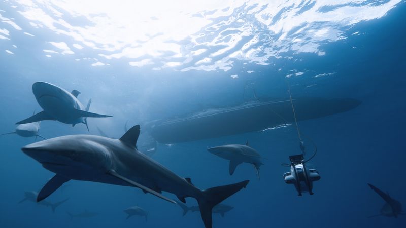
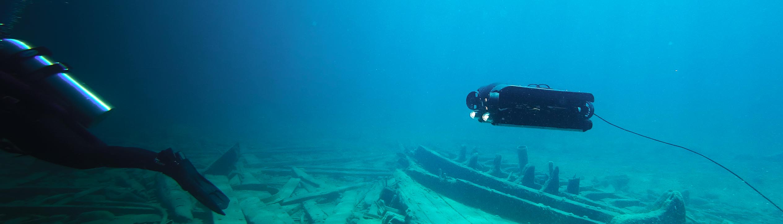
Sharks swimming with a Deep Trekker ROV
This article was first published on
www.deeptrekker.comExploring the Significance of Marine Research and Its Implications for Environmental Sustainability
When we think of the vastness of the ocean, it’s difficult to fully comprehend the true magnitude of it. Making up 71% of the earth’s surface, it’s baffling and amazing that over 80% of the oceans' depths remain unexplored. Even Nasa is exploring the oceans, hoping to learn more about our planet while training for future space missions in the most extreme environment on our planet. Another fun fact: We know more about the moon and Mars than the oceans. Let that sink in. Pun intended.
Marine science is a broad term referring to the research and interpretation of the marine biome. The study of marine science provides us with a better understanding of fish and plant populations, ocean climate changes, pollution, and biodiversity.
While marine science primarily focuses on saltwater and coastal regions, many of the same research approaches are applied to non-saltwater bodies, such as inland lakes and rivers. This field of study serves to explore and protect aquatic ecosystems, providing valuable insights for conserving natural resources and ensuring the sustainable management of marine and freshwater environments.
Marine science is essential for understanding ocean ecosystems, climate regulation, and biodiversity. It supports sustainable fisheries, vital for global food security, and helps address the impacts of climate change by revealing how oceans absorb carbon dioxide and heat. Without marine science, managing threats like species endangerment and ecosystem degradation would be nearly impossible, making it critical for both environmental health and human survival.
Challenges in Marine Science
Marine scientists face numerous challenges that complicate their efforts to understand and protect ocean ecosystems. Deep-sea exploration is costly and technologically demanding, with harsh conditions like extreme pressure, low temperatures, and unpredictable currents making research logistically complex. Climate change further complicates their work, requiring scientists to constantly adapt their research methods to rapidly changing and increasingly unpredictable environments. Ghost fishing gear - lost or abandoned fishing equipment - also continues to wreak havoc on marine ecosystems, forcing scientists to engage in both prevention and cleanup efforts.
Adapting Technological Innovation for Research
These challenges highlight the need for marine scientists to adopt advanced technologies. ROVs enable access to deep-sea environments, with advanced add-on tools and technologies that assist in monitoring climate change effects and addressing ghost fishing gear. Utilizing these technologies is crucial for improving research efficiency and safeguarding marine biodiversity.
The Evolution and Impact of Remotely Operated Vehicles (ROVs)
What is an ROV?
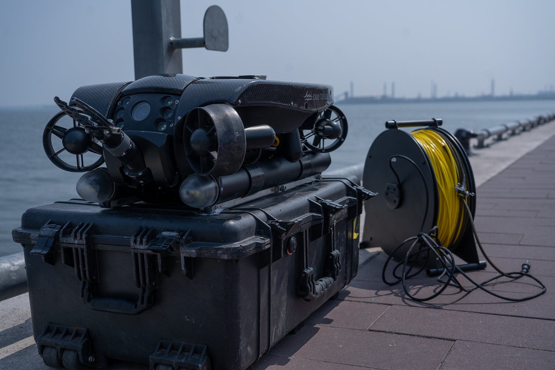
A Remotely Operated Vehicle (ROV) is an underwater robot designed for performing a wide range of tasks in environments that are challenging or hazardous for human divers. Operated by remote pilots on the surface, ROVs are equipped with an array of tools, including cameras, sensors, and manipulators. These capabilities enable ROVs to conduct underwater inspections, execute detailed surveys, and perform complex operations in marine environments.
Core Features and Functional Capabilities of an ROV
ROVs vary in size, from compact models weighing a few kilograms to larger units weighing several tons. They are equipped with cameras that provide real-time video feeds, robotic arms for manipulation, and an array of sensors for data collection. ROVs are connected to a surface control station via a tethered cable, which supplies power, transmits operational commands, and relays video and data back to the operator
General History of ROVs
The concept of ROVs dates back to the 1950s when they were first developed for military applications, such as recovering torpedoes. The first modern ROV, named POODLE, was developed by Dimitri Rebikoff in 1953. In the 1970s, ROVs played a significant role in discovering deep-sea hydrothermal vents, revealing unique ecosystems sustained by hot, mineral-rich water and transforming our understanding of the deep ocean. In 1986, the Deep Rover ROV located the wreck of the RMS Titanic, the deepest known shipwreck at the time.
These early remotely operated vehicles were basic in design and functionality, but they laid the groundwork for future advancements. Over time, the technology improved, and ROVs began to be used for commercial purposes, particularly in the oil and gas industry for underwater inspections of pipelines and rigs. As technology progressed, ROVs became more sophisticated, with enhanced maneuverability, better cameras, and advanced sensors. Today, they are widely used in various industries, including marine science, offshore energy, and underwater archaeology.
Marine Research Applications Enabled by ROVs
ROVs are versatile tools in marine science, enabling a wide range of applications from underwater inspections and surveys to detailed data collection in challenging environments. They enable researchers to monitor marine life, assess coral reefs, and study underwater geology. Their ability to operate in extreme conditions and perform tasks continuously makes them ideal for both research and conservation efforts, expanding our understanding and protection of the ocean.
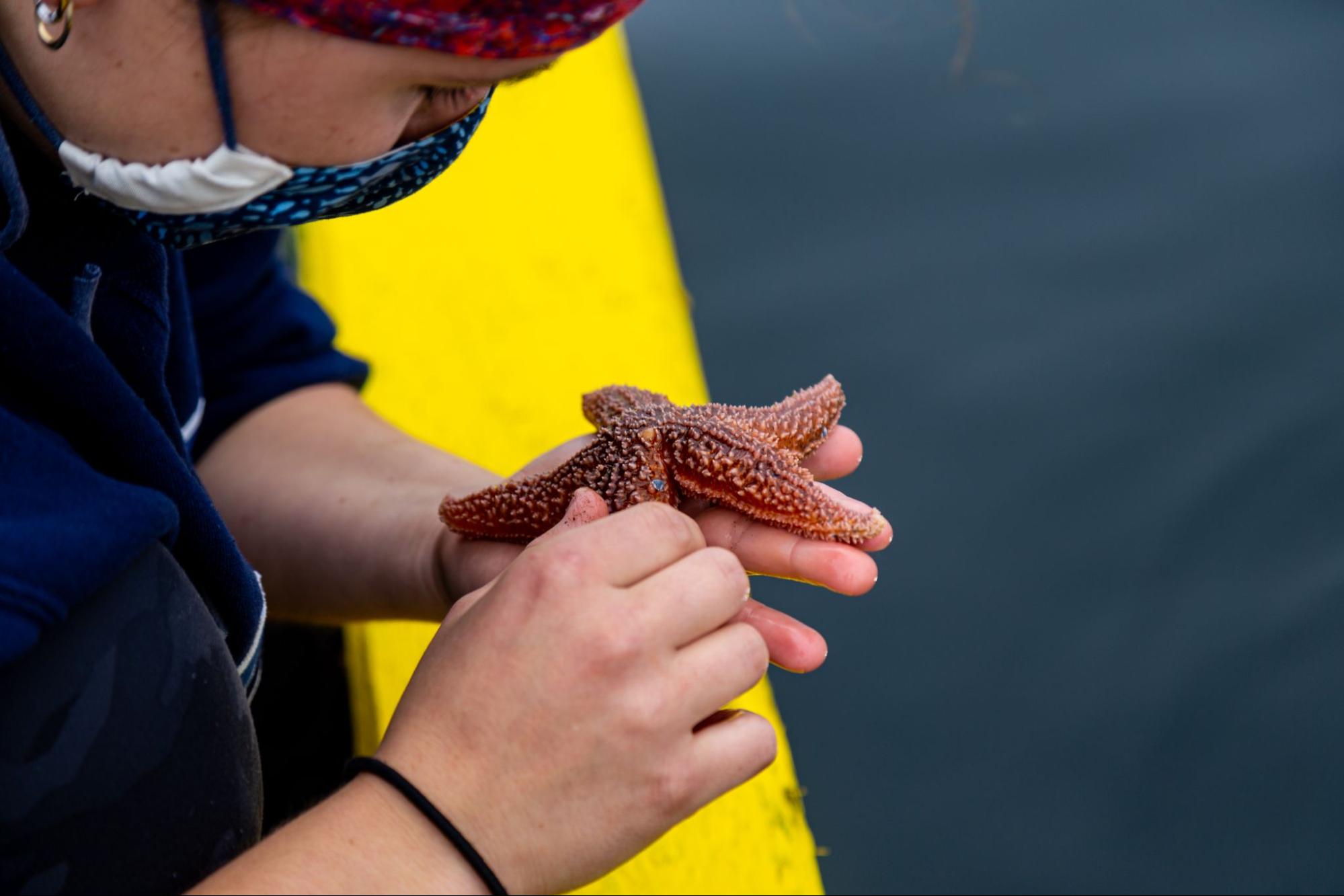
Species and Habitat Evaluation
Species and habitat evaluation is important for monitoring biodiversity, tracking invasive or endangered species, and studying the effects of climate change. This research helps scientists understand how ecosystems are changing and provides valuable data for conservation efforts.
Traditional Methods and Tools
Historically, species and habitat evaluations have relied on methods such as diver surveys and drop cameras. Drop cameras can provide valuable data from fixed points but are limited in their spatial coverage and effectiveness in poor water conditions. Their lack of maneuverability makes it challenging to follow and observe species behavior comprehensively.
Divers offer greater mobility and real-time observations, but their depth range is limited, and diving poses inherent safety risks. Moreover, the presence of divers can disrupt natural behaviors, potentially skewing data collection.
How ROVs Are Addressing Challenges
Easier and safer to deploy than divers, ROVs can collect high-quality visual information quickly and at lower costs. They perform well in sub-optimal conditions, such as murky waters, using technologies like sonar and turbidity filters. This makes ROVs versatile tools for gathering reliable data in various environments.
3D Modeling in Habitat Evaluation
ROVs have the ability to create 3D models of natural structures like coral reefs. These models can track ecosystem changes over time, particularly in response to climate change. ROVs equipped with photogrammetric capabilities can meet the demands of these 3D modeling tasks, offering detailed visual data for long-term ecological studies.
Sampling and Water Quality Analysis with ROVs
Water and sediment sampling, along with water quality analysis, are key components of marine research. While visual data from underwater inspections is valuable, it often needs to be complemented by non-visual measurements and physical samples. Such data enables scientists to assess environmental changes and track ecosystem health, particularly for species monitoring and biodiversity studies. By sampling both the water column and the ocean floor (the benthos), researchers can identify shifts in the environment that may not be immediately apparent from visual data alone.
Traditional Sampling Techniques and Their Limitations
Several traditional methods are used for water and sediment sampling:
Dredging: This large-scale method removes sediment from the sea or lakebed, often disrupting the environment but providing bulk samples for analysis.
Core Sampling: A cylindrical device is lowered to the seabed, capturing sediment in layers. The newer sediment is at the top, and the older sediment is at the bottom, allowing researchers to study changes over time.
Grabbing: This involves a claw-like device that captures a sample from the sea or lakebed, often used for collecting sediment or small organisms.
Environmental Sensors: Water quality analysis sondes are often used to measure parameters like temperature, salinity, and dissolved oxygen levels.
Limitations of Conventional Sampling Methods
While traditional methods can collect valuable data, they often have significant limitations. instance, dredging and grabbing can disrupt the environment and fail to provide context about the sample’s exact location. Deep-water missions using these methods also often require a boat equipped with cranes or pulley systems, adding logistical complexity and cost. Sensors also present challenges in retrieval and can be quite costly when they are lost.
ROVs as a Solution to Traditional Sampling Challenges
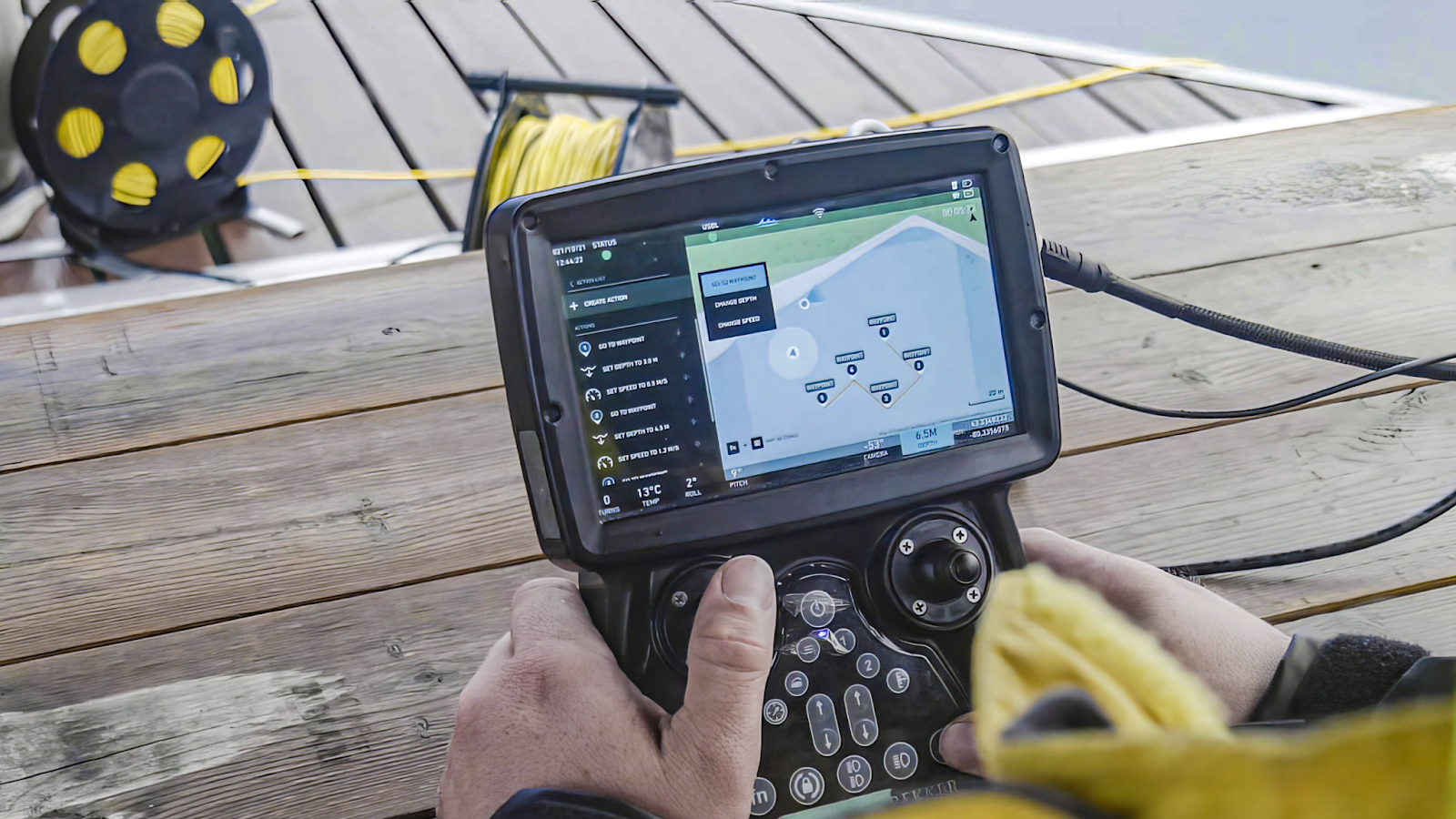
ROVs offer a solution to many of the challenges associated with traditional sampling methods. Rather than deploying a dive team or stationing a mooring or profiler, an ROV can be deployed and piloted directly to an area of interest, allowing researchers to precisely locate and revisit sampling sites. Equipped with GPS and Dead Reckoning capabilities, Deep Trekker ROVs can lock in coordinates, enabling consistent site monitoring and long-term environmental studies.
ROVs can be integrated with various sampling tools, such as sediment corers, grabbers, and water quality sensors. This allows for the collection of both visual data and physical samples simultaneously, providing a comprehensive picture of the environment. The use of ROVs also eliminates the need for large boats or complex deployment systems, reducing operational costs and logistical hurdles.
The Mission Planner feature on Deep Trekker ROVs also enhances their utility, allowing researchers to visit and monitor specific points of interest efficiently. Over time, this data can be compiled to track changes in carbon levels, water temperatures, salinity, phosphorus levels, and other critical parameters. Such data is invaluable for planning new aquaculture sites, guiding conservation efforts, and deepening the understanding of marine ecosystem dynamics.
By using ROVs, scientists can gather accurate, repeatable data that bridges the gap between traditional sampling methods and modern environmental monitoring needs.
Bathymetric Surveys
Bathymetric surveys involve the precise measurement and mapping of seafloor or lakebed depths and contours. These surveys are crucial for various applications, including studying coastline changes, assessing benthic habitats, and predicting water conditions like tides and currents. Bathymetric data helps scientists and engineers understand underwater topography, which is essential for activities ranging from marine navigation to environmental conservation.
Traditional Bathymetric Surveying Techniques
Traditional methods for bathymetric surveys include:
Manned Boats with Altimeters: Altimeters on boats collect altitude data, which can be converted into depth measurements. However, this method is time-consuming and requires significant resources.
Multibeam Echo Sounders: These devices, often attached to manned vessels or Autonomous Underwater Vehicles (AUVs), emit sound waves that bounce off the seafloor and return to the device. The time it takes for the sound waves to return provides depth data, allowing for a detailed map of the ocean floor. Currently, large sections of the ocean are being mapped using multibeam echo sounders, providing a broad overview of underwater topography.
Limitations of Traditional Surveying Methods
While traditional bathymetric surveying methods are effective, they come with several challenges. Using altimeters on manned boats is labor-intensive and time-consuming, often requiring extended periods on the water to gather comprehensive data. Boat-mounted echo sounders, although highly accurate, can be costly to operate, particularly when surveying large or remote areas. Deploying AUVs for this purpose also requires substantial infrastructure and expertise, further increasing costs.
Leveraging ROVs to Address Surveying Challenges
ROVs, while not typically the primary choice for large-scale bathymetric surveys, excel in accessing challenging or confined areas where traditional methods may be less effective. Equipped with Doppler Velocity Logs (DVLs), ROVs can capture accurate depth data, which can be processed with specialized software to generate detailed seafloor maps.
Combining DVL data with precise location mapping, ROVs offer a flexible solution for conducting bathymetric surveys in environments that may be inaccessible to larger vessels or AUVs. This capability enhances the ability to gather detailed data from difficult-to-reach areas.
Specialized Applications of ROVs in Bathymetric Surveys
Beyond conventional bathymetric surveys, ROVs can also be deployed for unique tasks, such as scanning the underside of sea ice to conduct surveys and obtain measurements. This capability is particularly useful in polar regions, where traditional methods may not be feasible.
ROVs are also increasingly used for photogrammetry, especially in coral reef surveys, bottom surveys, and mapping. Photogrammetry allows for the creation of detailed 3D models of the seafloor or reef structures, which can be vital for monitoring and preserving these delicate ecosystems. The Department of Fisheries and Oceans (DFO) has been exploring such technologies to enhance marine habitat protection and research.
By integrating ROVs with modern survey tools, scientists and researchers can achieve high-quality, detailed bathymetric data while overcoming the limitations of traditional methods.
Ghost Gear Recovery
Ghost gear refers to lost or discarded fishing equipment, such as nets, lines, and traps, that continue to cause harm long after being abandoned. This debris poses a serious threat to marine ecosystems, as it can entangle and be fatal to marine life, such as fish, turtles, and seabirds. Over time, ghost gear breaks down into microplastics, further polluting the water and affecting marine species. It also presents a safety hazard to boats and people using the waterways.
Traditional Methods for Ghost Gear Recovery
Ghost gear recovery has traditionally relied on:
Divers: Divers are deployed to locate and retrieve ghost gear manually, a method that can be effective but also risky due to the hazardous nature of the gear.
Drag & Drop Method: This involves dragging a line or net behind a boat in the hopes of catching ghost gear. While this can sometimes retrieve debris, it is a blind process, often disrupting the seafloor and damaging marine habitats.
Limitations of Traditional Recovery Approaches
The traditional approaches to ghost gear recovery come with significant challenges:
Dragging: This method is inefficient, as it relies on blind retrieval, hoping to catch something. Additionally, it is highly disruptive to the environment, potentially causing more harm than good.
Diving: Although more targeted, diving poses substantial risks. Ghost gear can easily entangle divers, making this method dangerous and limiting the areas that can be safely accessed.
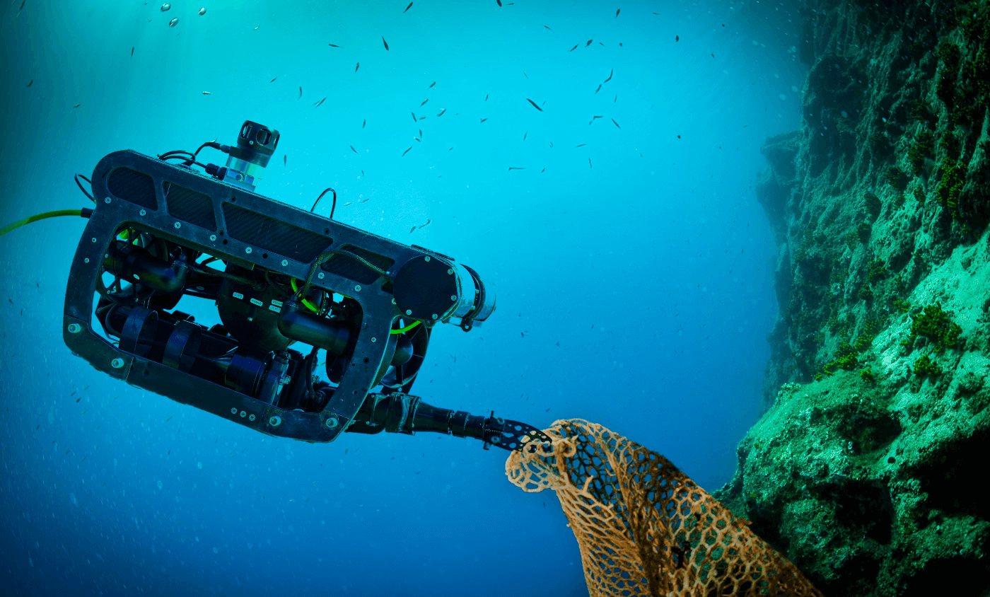
Advantages of ROVs in Ghost Gear Recovery
ROVs offer a safer and more efficient alternative for ghost gear recovery. ROVs can be deployed to precisely locate ghost gear, eliminating the need for blind dragging and minimizing environmental disruption. Equipped with cameras, sonar, and grabber arms, ROVs can identify and retrieve ghost gear directly, reducing the risks associated with diver-based recovery.
By keeping divers out of harm's way and providing a more targeted approach, ROVs enhance the safety and effectiveness of ghost gear recovery operations and protect the integrity of the environment.
Benefits of ROVs for Aquatic Research
Built for Rugged Environments
ROVs are engineered to operate in harsh underwater conditions. Built to be durable against impact, sub-zero temperatures, and unpredictable currents, ROVs can be effectively used in many challenging situations. Pressurized to withstand immense depths, these vehicles can dive up to 1,000 feet for deep sea research. Unlike human divers, ROVs can safely perform tasks in these extreme environments, mitigating the risks associated with human life in such conditions.
ROVs eliminate risks such as injury, hypothermia, and decompression sickness by operating in extreme environments without exposing humans to these dangers. They handle physical strains, withstand high pressures, and can operate for extended periods without the fatigue and decompression constraints that limit human divers. Controlled remotely from a safe location, ROVs ensure that personnel remain out of hazardous conditions while still providing critical data and insights.
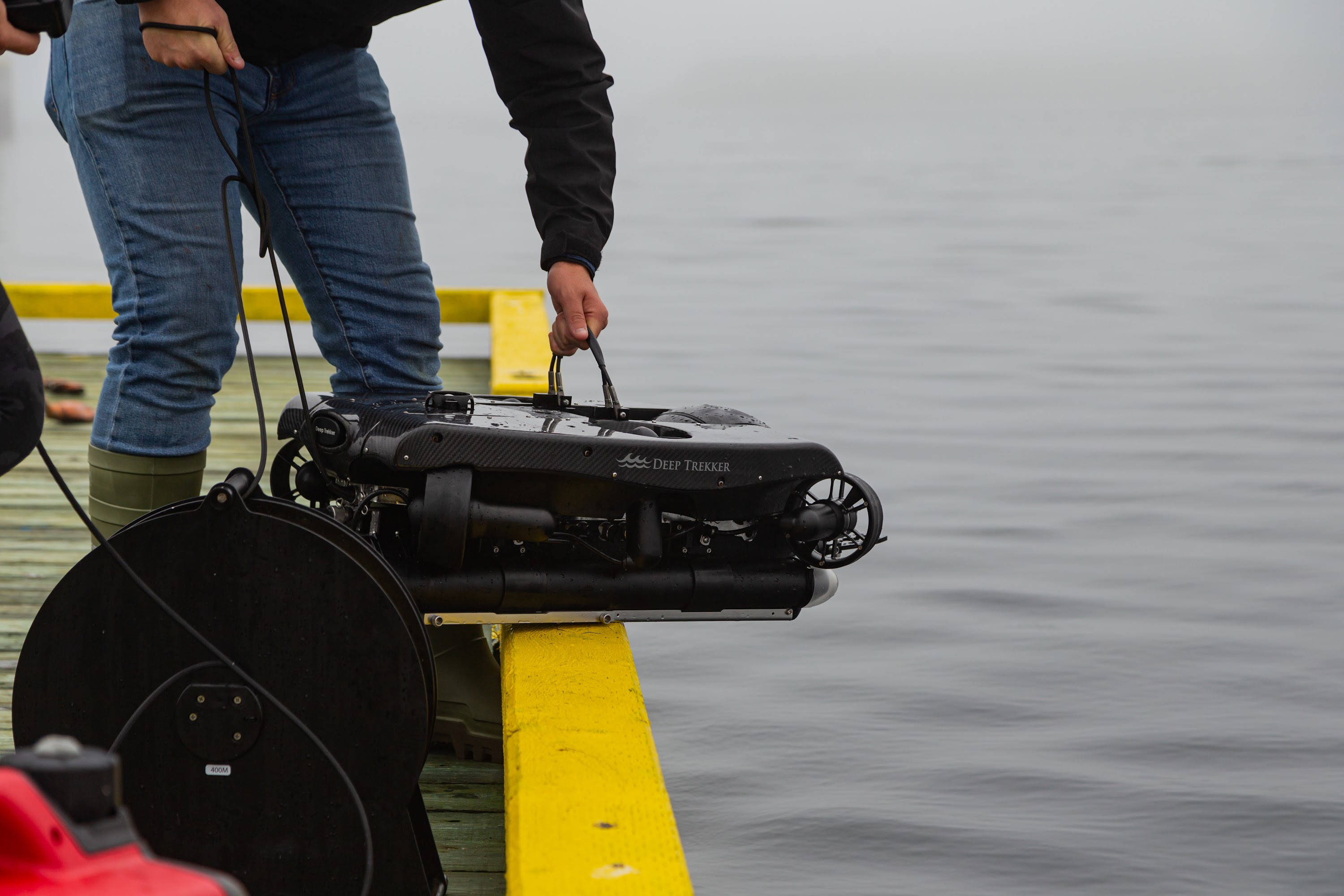
Portable
Marine research often occurs in remote or coastal areas, making portability crucial. Weighing between 20-60 lbs, ROVs are easy to transport and deploy, allowing a single operator to quickly set up and begin underwater inspections or sample collection. Being battery-powered, ROVs are well-suited for conducting research in isolated or offshore locations where access to power sources is limited. Deep Trekker ROVs can offer several hours of operation, but for longer missions or challenging conditions, such as high currents or low temperatures, direct power options are available.
Easy to Operate
ROVs are user-friendly and unlike drones, do not require any licensing to operate. Intuitive controls and low-latency camera displays make operation easy to pick up. This ease of use makes ROVs ideal for educational settings, where students can learn quickly, and for team-based research, where the ROV can be passed among team members as needed.
Quality Imaging
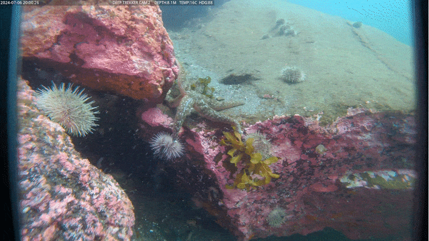
Ultra high-resolution imaging is vital for marine science, particularly for assessing species and habitats. Deep Trekker ROVs provide exceptional visual clarity with features like auto-white balancing and turbidity filters. They also support easy recording via SD cards or external computers, making it simple to store long records of 4K video and images.
Add-Ons
ROVs offer versatility by being configurable to meet specific customer needs, enabling multiple functions from a single system, reducing the need for separate, more expensive equipment. They are designed for long-term use, with the ability to adapt to evolving requirements through system upgrades, software updates, and the addition of new attachments.
Deep Trekker ROVs can be equipped with different sized samplers for water and sediment, water quality sondes, dissolved oxygen sensors, hydrophones, and more, allowing for custom builds to suit specific project requirements.
Water Samplers: Allows for the collection of water samples from various depths and locations.
Sediment Samplers: Provides a reliable method for obtaining sediment from seafloors and lake beds.
Water Quality Sensors: Enables real-time water quality measurements, reducing the need for post-dive testing.
Size Measurement Tools: Includes calipers or laser scalers for accurate dimensional data on underwater objects.
These add-ons enhance the versatility of ROVs, allowing them to be adapted to changing research requirements through system upgrades, software updates, and new attachments.
Advancing Marine Research into the Future: The Next Generation of ROV Technology
Advancements in ROV technology are set to transform marine science, which will afford us a much greater understanding of the underwater world, with more accurate data and less disruptive techniques and practices at our fingertips.
Increased autonomy will streamline data collection, making it more efficient and less dependent on manual operation. The integration of AI will enhance imaging and data analysis, providing researchers with higher-quality data and deeper insights, much faster than was ever possible before. Future ROVs will also feature improved functionalities, such as more precise location mapping, advanced camera systems, and much more, enabling even more detailed observations.
ROVs will be essential tools in future marine research, particularly in studying climate change and exploring previously inaccessible regions and depths. These vehicles will allow researchers to investigate challenging environments safely, potentially leading to groundbreaking discoveries. With ultra high-resolution imaging, ROVs will make marine findings more accessible to the public, offering unprecedented and awe inspiring views of the underwater world.
Deep Trekker Difference
Deep Trekker is a leading provider of industrial grade, versatile ROVs designed for various underwater applications. Our lineup includes the classic DTG3, known for its portability and ease of use; the REVOLUTION, featuring advanced maneuverability, camera control, and payload; the PIVOT, with its enhanced stability and modularity; and the PHOTON, the newest vehicle in the family, with the portability of the DTG3 and the maneuverability of the REVOLUTION, it’s the toughest micro ROV on the planet. Step up, fellow micro’s, if you think you have the mettle (metal) to hold your own against this little powerhouse.
Deep Trekker also offers a range of specialized add-ons to customize ROVs for specific research needs. These include water samplers, sediment samplers, multiparameter sonde, and more. For more complex tasks, the grabber arm and location mapping tools can enhance the ROV’s functionality, with the Mission Planner offering advanced breadcrumbing and waypoint mapping for long-duration or large area missions.