Podcast: Fighting Wetland Loss From Outer Space
In this episode, we talk about how a method leveraging ground data and satellite imagery can help prevent wetland losses.
29 Nov, 2022.
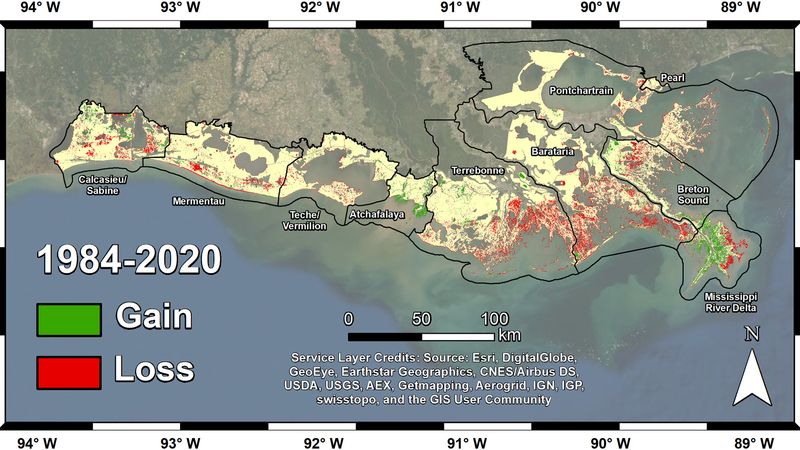
The researchers mapped land change in coastal Louisiana from 1984 to 2020. Basins that failed to build new soil, such as Terrebonne and Barataria, experienced the most land loss – more than 180 square miles (466 square kilometers). Credit: Jensen et al. Journal of Geophysical Research: Biogeosciences
In this episode, we talk about how a method leveraging ground data and satellite imagery can help prevent wetland losses.
This podcast is sponsored by Mouser Electronics.

EPISODE NOTES
(2:42) - Satellites Help Scientists Track Dramatic Wetlands Loss in Louisiana
This episode was brought to you by Mouser, our favorite place to get electronic components for any project. Click HERE to learn more about the intricacies of deep space communication!
As always, you can find these and other interesting & impactful engineering articles on Wevolver.com.
To learn more about this show, please visit our shows page. By following the page, you will get automatic updates by email when a new show is published. Be sure to give us a follow and review on Apple podcasts, Spotify, and most of your favorite podcast platforms!

The Next Byte Newsletter
Fuel your tech-savvy curiosity with “byte” sized digests of tech breakthroughs.